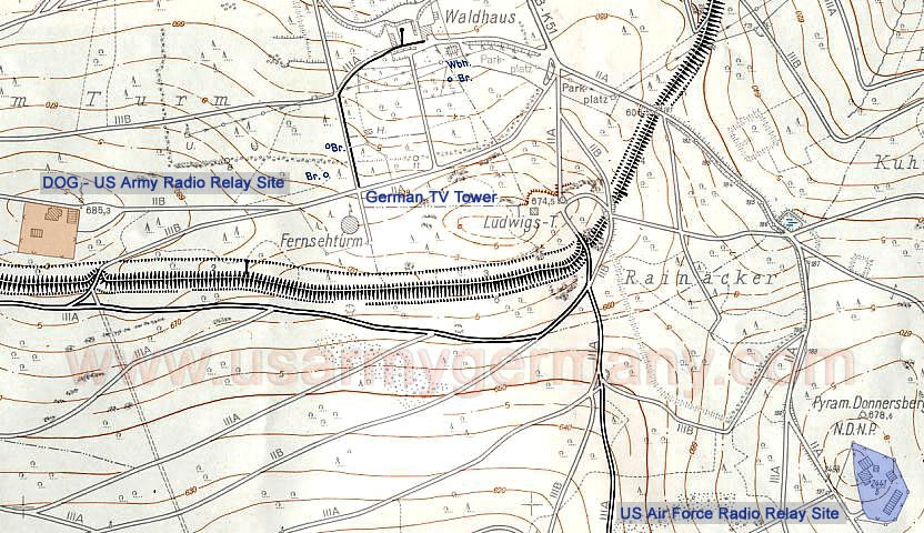
U.S. Military Installations in the Donnersberg area - 1963
(Source: RenéMeier)
Found a Donnersberg map dated exactly 1963. I did a lot of detective work to find this “old” map.
On the left
(highlighted in orange) you see DOG, the US Army Radio site, followed by - moving to the right - the German Südwestfunk TV Tower, the Ludwigs Tower and, in the right corner, the Air Force Radio Site (highlighted in blue).
The buildings at our Army site: in the right corner were the sleeping quarters and a community room; behind it (to the left) the Radio building with the kitchen and, left below, the 40kW Generator house. The wells marked with “Br.” are the locations where we filled up our water tank trailers to bring up to the site for filling our water tanks.
|