Click here to open 'USArmyGermany' frameset
MAINZ ARMY DEPOT |
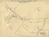
WACKERNHEIM MSL SITE |
|
MAINZ R&U AREA |
For additions, corrections, or suggestions please contact the webmaster
|
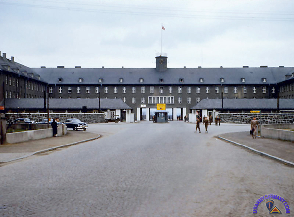
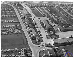
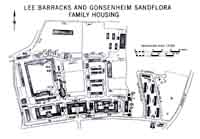 1. Lee Barracks, 1970s |
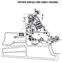 2. Finthen Army Airfield, 1970s |
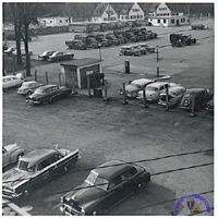
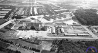
 3. McCully Bks, 1953 |
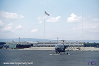
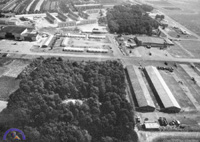
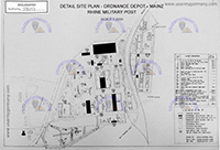 4. Mainz Ord Depot, 1951 |
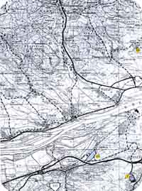
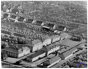
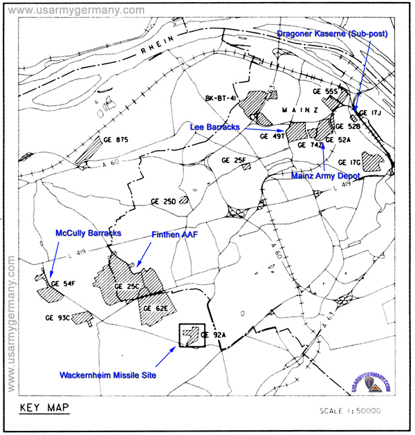
| 1980 Topographical map of Mainz and surrounding area. This map is reproduced from the "U.S. Military Installation Atlas" published by the 37th Transportation Group in 1980. Click on the thumbnail to view a larger format of the same map. Click here for a list of the installations. |
 |
 |
 |
|
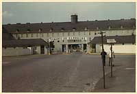
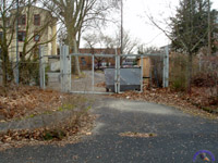
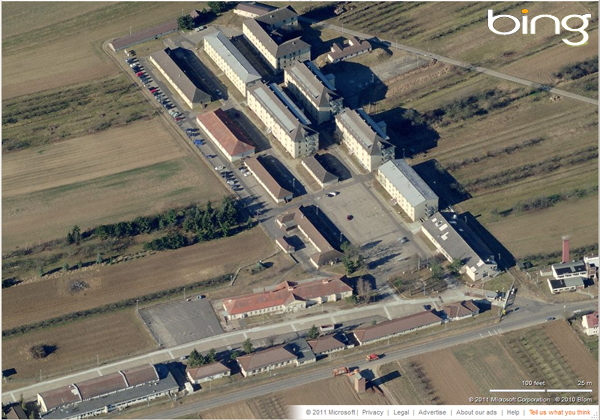
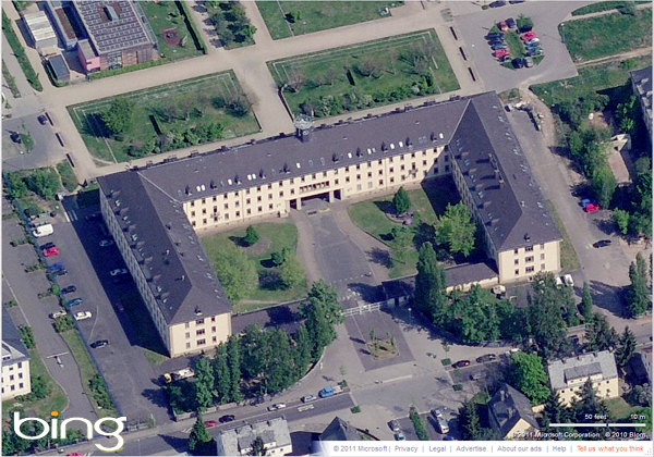 Former Lee Barracks, Mainz-Gonsenheim (Bing) |
 Mangin Kaserne, Mainz-Gonsenheim, 1954 (Walter Johnson) |
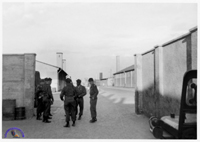
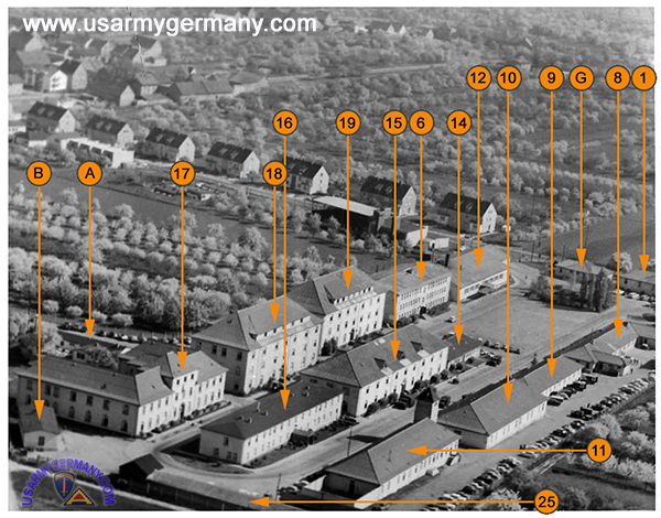
 1. Lee Barracks, prob early 1970s |
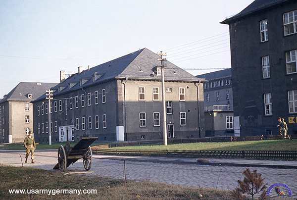
 2. Bldg 4 from the parade ground |
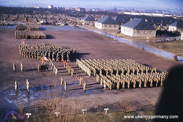
 3. Parade ground |
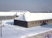 4. Winter 1955 |
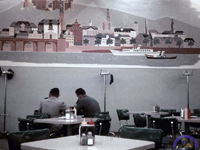 5. Snack Bar |
|||
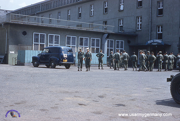
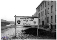 6. 1st BG, 5th Inf sign |
 7. Lee Barracks, 1958 |
 8. Side gate |
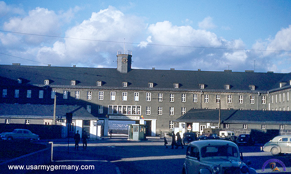
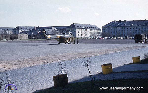
 9. 2nd Armd Div H-13 at Lee |
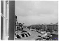
 10. Looking towards main gate |
||
 H-19 helicopter of 8th Aviation Company, 1958 (Webmaster's collection) |
 Mess hall of one of the infantry battle groups at Lee Barracks, 1958 (Webmaster's collection) |
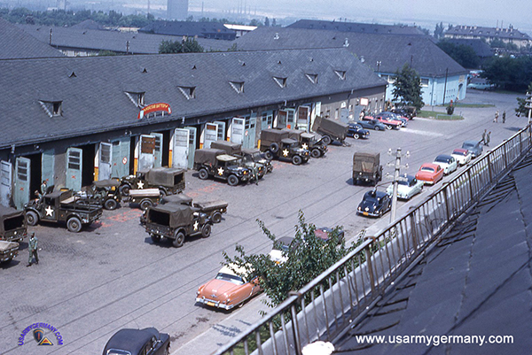 Motor pool on left, 1958 (Webmaster's collection) |
 11. 543rd Ord maint building |
 12. Communications shelter |
 13. Looking towards T-6133 |
||
|
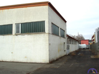
a.k.a. Dragooner Kaserne |
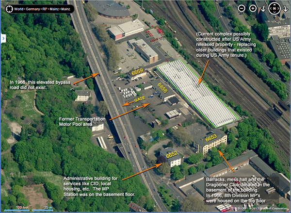
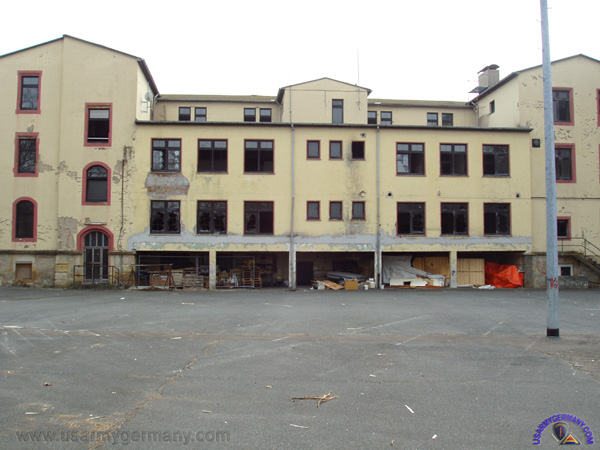
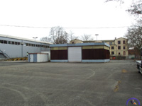
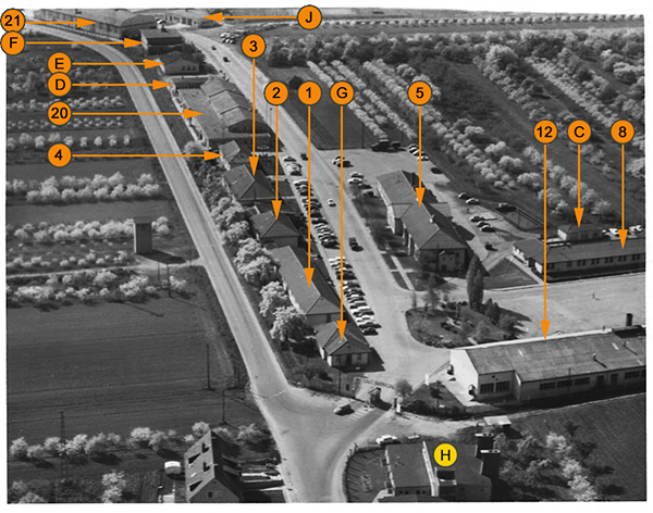
 1. Bldg #6656 Maintenance |
 2. Side view of bldg. |
 3. Back of Bldg #6656 |
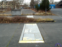 4. A vehicle scale? |
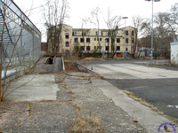 5. TMP wash rack? |
 6. Unknown building in center |
 7. Another unknown shed |
 8. Main entrance to TMP? |
 9. Fence separating TMP from MILCOM compound |
|||
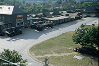
 10. Mainz TMP, early 1960s |
 11. Dragooner Ksn, 1966 |
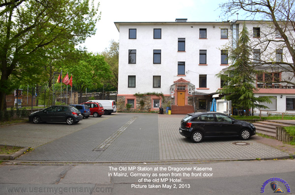
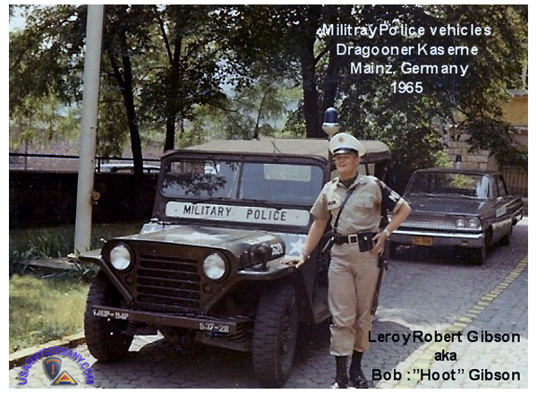
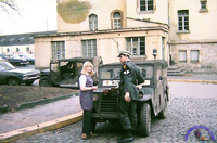 12. MP Station, 1968 |
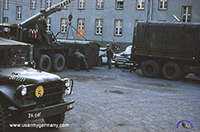
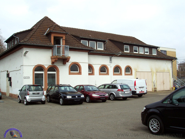
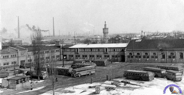 The former Army Bus Depot at Dragooner Kaserne, 1954 |
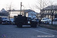
 The former MP Station at Dragooner Kaserne (David Joseph Perrault) |
 The former MP Station at Dragooner Kaserne (David Joseph Perrault) |
 The former MP Station at Dragooner Kaserne (David Joseph Perrault) |
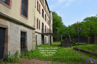 13. Former MP barracks |
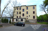 14. Former MP barracks |
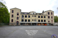 15. Former MP barracks |
||
|
 Former Finthen Army Airfield, Finthen (BING) |
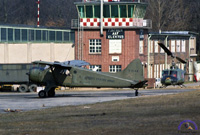 1. Finthen AAF, 1964 |
 2. Aerial of Finthen AAF, 1965 |
 3. Aerial of Finthen AAF, 1965 |
||
|
HQ 106th Trans Bn change of command ceremony, 1970 (John D'Asto) |
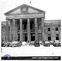
 78th Trans Co motor pool, Azbill Barracks, c. 1975 (Ek Paul Prengel) |
 Former Azbill Barracks, Rüsselsheim (Bing) |
|
||||
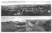 A. Wackernheim |
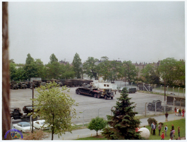
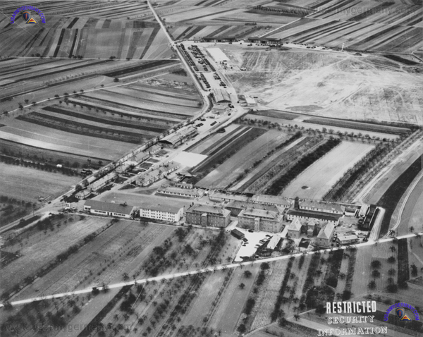 McCully Barracks, Wackernheim, 1953 |
|||
|
|||
|
|||
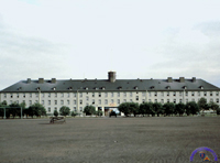
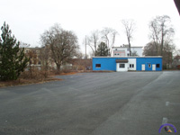
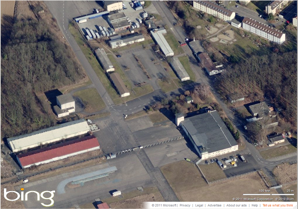
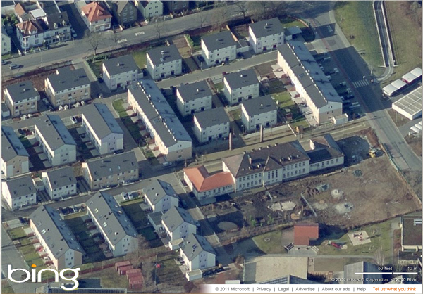
 Former McCully Barracks, Wackernheim (Bing) |
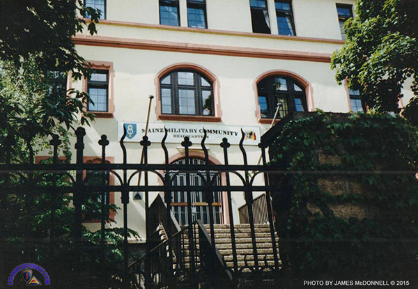
MILCOM Headquarters Building, Dragoner Kaserne, Summer 1988 (James McDonnell) |
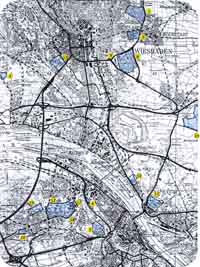
 US Army installations, housing & training areas in the Mainz area, 1985 |
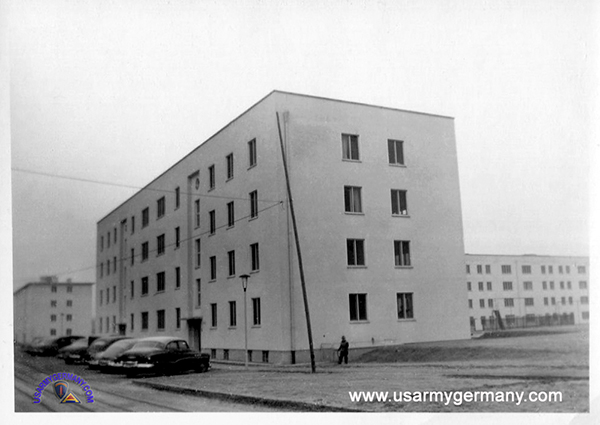 Dr. Martin Luther King Jr. housing area in Mainz, 1953 (Identified by Daniela Corzelius - As I was working in Mainz Military Community from February 1984 until closure in 1992, I know the installations pretty well. The pictures showing the "unidentified housing in or near Mainz," were taken in the Dr. Martin Luther King Village, in Mainz (Dr.Martin-Luther-King-Weg, John-F-Kennedy-Straße, Thomas-Jefferson-Strasse, Eduard-Frank-Strasse.) |
 Dr. Martin Luther King Jr. housing area in Mainz, 1953 |
1952
(Source: Email from Lawrence "Larry" Jones III)
From June 1952 through June 1954 I lived with my father, mother & sister in Aschaffenburg and then Mainz. I was 7 years-old when we moved there.
Dad was a WWII vet and stationed in Germany after the war. We joined him in Mainz. Long story short, I’ve got a few photographs of our military dependant housing. I think our housing had been used by the Wehrmacht during the war. Not 100% sure about that. But, it was within a large fenced area somewhere in Mainz. There were woods nearby and we often heard unexploded ordnance blowing up while sitting in school. Our German teacher was a former Wehrmacht soldier. We played in the woods (it was forbidden) and I remember several collapsed bunkers and a nearby area where there were quite a few recessed-in-the-ground concrete rectangular areas where German 88’s were placed to shoot at allied aircraft.
I suppose by now the housing and large military compound are long gone. Wish I remembered the exact name. Mom and Dad are deceased too and I’m nearing 74 years of age.
I’ve always wanted to go back to Mainz and try to visit where we lived. The memories of that period of my life as still quite strong. There still were “no fraternization” laws and we weren’t supposed to talk to Germans….although we did.
We would go to Wiesbaden every Sunday to the Eagle Club. Often, we would see pro-Nazi slogans being cleaned from the walls of buildings as there were still some diehard Nazi’s about. It was a weird time to be sure, but I remember it with fondness.
While going through the photographs one by one, and reading the identifications written on the back of some of them by my Mom, I realized that most of the photos I have are of our quarters when we lived first in Aschaffenburg in 1952. After a few months there, we were transferred to housing in Mainz. My Dad actually worked in Wackernheim with the 78th AFB BN, 2nd Armored Division.
Some information on the attached photos:
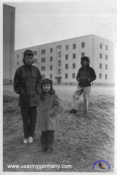
-- Two show our quarters in Mainz. My Mom, sister and I appear in the photos. My Dad was a sergeant so this is NCO housing.
-- I also attached a snapshot my Dad made of the Eagle Club one snowy Sunday afternoon in Wiesbaden. We ate there almost every Sunday. I can clearly remember seeing the ghost shadow on one wall of a WWII Luftwaffe eagle. The Eagle Club was the first place I ate great potato salad and the first place where I ever ate a crème puff. Those were good times.
(Webmaster's note: Can anyone identify which housing area this was in or around Mainz (see photos above))
Dad was a WWII vet and stationed in Germany after the war. We joined him in Mainz. Long story short, I’ve got a few photographs of our military dependant housing. I think our housing had been used by the Wehrmacht during the war. Not 100% sure about that. But, it was within a large fenced area somewhere in Mainz. There were woods nearby and we often heard unexploded ordnance blowing up while sitting in school. Our German teacher was a former Wehrmacht soldier. We played in the woods (it was forbidden) and I remember several collapsed bunkers and a nearby area where there were quite a few recessed-in-the-ground concrete rectangular areas where German 88’s were placed to shoot at allied aircraft.
I suppose by now the housing and large military compound are long gone. Wish I remembered the exact name. Mom and Dad are deceased too and I’m nearing 74 years of age.
I’ve always wanted to go back to Mainz and try to visit where we lived. The memories of that period of my life as still quite strong. There still were “no fraternization” laws and we weren’t supposed to talk to Germans….although we did.
We would go to Wiesbaden every Sunday to the Eagle Club. Often, we would see pro-Nazi slogans being cleaned from the walls of buildings as there were still some diehard Nazi’s about. It was a weird time to be sure, but I remember it with fondness.
While going through the photographs one by one, and reading the identifications written on the back of some of them by my Mom, I realized that most of the photos I have are of our quarters when we lived first in Aschaffenburg in 1952. After a few months there, we were transferred to housing in Mainz. My Dad actually worked in Wackernheim with the 78th AFB BN, 2nd Armored Division.
Some information on the attached photos:
-- Two show our quarters in Mainz. My Mom, sister and I appear in the photos. My Dad was a sergeant so this is NCO housing.
-- I also attached a snapshot my Dad made of the Eagle Club one snowy Sunday afternoon in Wiesbaden. We ate there almost every Sunday. I can clearly remember seeing the ghost shadow on one wall of a WWII Luftwaffe eagle. The Eagle Club was the first place I ate great potato salad and the first place where I ever ate a crème puff. Those were good times.
(Webmaster's note: Can anyone identify which housing area this was in or around Mainz (see photos above))
 1. Eagle Club, Wiesbaden |
|
The picture of Bldg 6653 is the back of the MILCOM's Headquarters and MP barracks. To the front left on the first floor was the BG's office suite (complete with bulletproof curtains and windows), middle square windows were bathrooms, and top floor was barracks. I was part of the PAO on second floor right side back, and my office was right below the barrack's bathroom, which made for interesting overheard conversations. I worked there in the mid-1980s.
A little further down is a picture of vehicle scales with a "?," and I believe those were part of vehicle inspection, with a metal doors covering a recessed area where the mechanic could inspect the underside of the car.
The former Lee Barracks building is being developed into an upscale apartment complex - http://www.dolphin-capital.de/wp-content/uploads/2013/11/131114_NEWS_www.allgemeine-zeitung.de_region_mainz.pdf
There's a Facebook page for the Mainz MP Station and I'll post the link there if anyone wants to add any info.
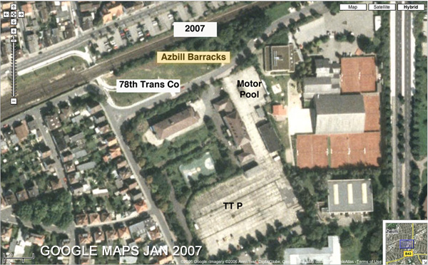 GOOGLE Maps sat view of former Azbill Barracks - accessed Jan 2007 (John D'Asto) |