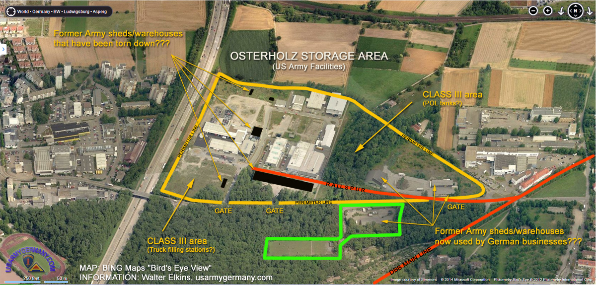
Osterholz Class III Supply Point, Ludwigsburg
(Source:
BING Maps & usarmygermany.com)
The area defined by the yellow perimeter line is -- what I believe -- the former Osterholz POL storage site. The black squares and rectangles are the locations of former buildings - based on an old topographic map I have of the area. Those buildings have been torn down to make way for new construction once German commercial firms after the facility was returned to the German government (1996?). The area just south of that (green perimeter) was another Army facility that might not have been directly linked with the POL mission of the Class III Supply Point.
(I would be very interested in hearing from anyone who can provide additional details or photos -- webmaster)
|
|
|